
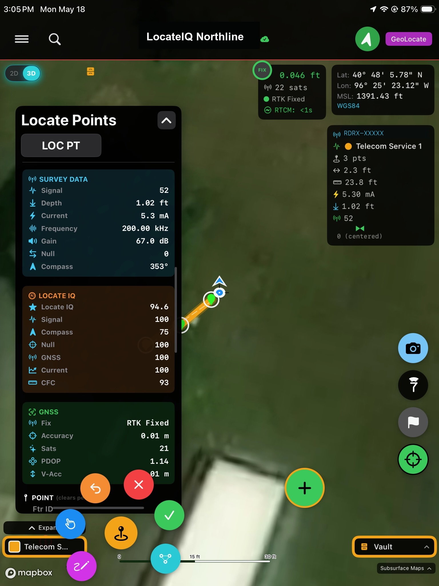
Capture field locates with survey-grade precision.
Utility LocateIQ helps utility locators collect points, lines, photos, AGMs, and relocation-ready data on iPhone and iPad. It supports local-only projects, ArcGIS, and Subsurface Maps from the same app.
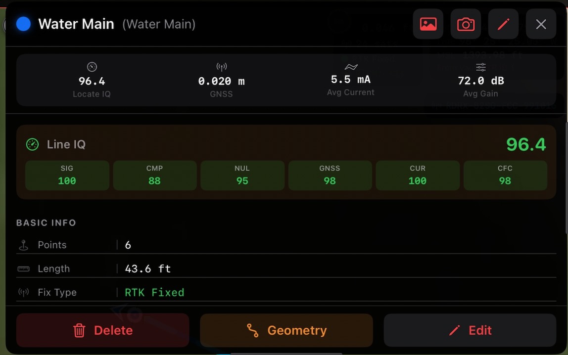
Every line carries its own confidence score.
Aggregate the per-point IQ ratings into a single line score with weighted breakdowns across signal, compass, null, GNSS, current, and CFC — so you can defend every locate during construction or as-built review.
- • Dynamic circular field detection identifies bleedoff and distorted EMF
- • Real RTK Fixed accuracy and current draw stored with every line
- • Photo attachments, geometry tools, and edit history per feature
Built for utility locate collection and relocation.
Utility LocateIQ is built around the locator workflow: collect the utility, classify it, document it, and keep it usable for relocation later.
- ✓Capture utility lines, utility points, locate points, photo points, laser locate points, and AGM points.
- ✓Move or edit collected geometry in the field and keep project data organized by layer.
- ✓Attach geo-referenced photos and notes directly to collected features.
- ✓Use feature-specific attributes and symbology tuned for utility workflows.
- ✓Connect utility locate receivers and RTK receivers over Bluetooth for field collection.
- ✓Support survey-grade receivers and app socket connections, with a built-in NTRIP client for direct RTK use inside the app.
- ✓Work fully local when needed, or connect to ArcGIS or Subsurface Maps when cloud sync is needed.
- ✓Create, open, and manage multiple field projects from the device.
Cloud utility mapping workflow
Sign in with Subsurface Maps, create or import map layers, collect field features, and sync feature updates and attachments back to the cloud.
- ✓Map and layer selection directly from the device.
- ✓Field-friendly utility symbology and collection defaults.
- ✓Attachment support for field photos.
Enterprise GIS workflow
Connect to ArcGIS Online or Enterprise, work against configured feature layers, and collect directly into organization-managed GIS data.
- ✓ArcGIS sign-in and project selection in app.
- ✓Feature collection aligned to configured layer schemas.
- ✓Field data capture without forcing a separate mobile GIS workflow.
For teams that need locate data to stay useful after the field visit.
Utility LocateIQ is built for utility locators, GIS-backed field crews, and project teams that need more than a pin on a map. It is intended for capturing relocation-ready observations with structure, photos, and layer-specific attributes.
Typical use cases include utility locating, relocation documentation, as-built updates, field verification, and mobile collection into ArcGIS or Subsurface Maps.
Support, company details, and review links.
Utility LocateIQ is produced by Subsurface Maps. For product questions, account setup, or review follow-up, use the links below or contact Brent Briley directly.
- Company: Subsurface Maps
- Application: Utility LocateIQ
- Technical contact: Brent Briley, brent@subsurfacesolutions.com